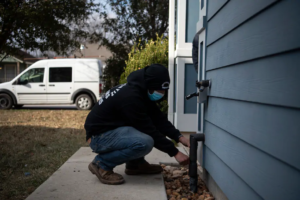
 The abrupt change in temperature could create new complications
After more than a week of dealing with brutal Arctic temperatures 50 degrees below normal at times, the Plains and the south central United States are just about done with the cold. Texas has only one more night of extreme cold to contend with, the bitterly frigid air retreating into the Northern Tier and Canada once again, but with new issues on the way — the thaw.
While climbing temperatures are a welcome reprieve for the hundreds of thousands of Texans struggling to keep warm, it comes at a price. Dramatic temperature swings can be notoriously challenging for infrastructure.
Snow and ice falling from buildings can be dangerous, while refreezing moisture on roadways could transform them into a sheet of ice. Potholes could form on area roadways, too. Meanwhile, more water main breaks and bursting pipes are likely.
Cold lingers Friday, but it’s the beginning of the end
Before the thaw begins in earnest this weekend and next week, record cold persisted Friday in parts of the Southern Plains, which continued to deal with power outages and widespread damage stemming from burst pipes and water main breaks.
Live updates: Water and heat failures persist amid extreme cold in Texas; Oklahoma rattled by earthquake
Oklahoma City dropped to 3 degrees early Friday morning, breaking the record low of 7 set in 1903. Lawton, Okla., home to Fort Sill, fell to zero.
In Texas, Austin, Victoria and Abilene all set records as well, falling to 20, 24, and 5 degrees, respectively.
Improvement was in the works Friday, though, when Waco, Tex., was expected to hit 36 degrees for the high. That would be its first time since Feb. 10 to hit freezing. The city broke its record for longest freezing stretch, beating out 190 hours in January 1948. Waco had made it up to 78 degrees earlier this February.
In Dallas, a still-chilly high of 35 degrees was forecast Friday, with the mid-40s in Houston. These temperatures are still about 20 to 25 degrees colder than normal.
There is an end in sight, however. Friday night will be the last with dangerously cold temperatures, with the cold easing Saturday into Sunday.
Dallas was forecast to drop to 22 degrees Friday night; Saturday night’s low will be closer to 44 degrees. In Austin, those numbers were 23 degrees Friday night and 38 on Saturday night, while Saturday night’s low in Houston will be 20 degrees warmer than Friday night’s.
Across the Panhandle and west Texas, the cold was already being scoured out by breezy southwesterly winds. Amarillo, which spent an entire week below 22 degrees, was looking at a projected high of 55 Saturday. The city hit minus-11 Monday morning and never made it above 7 degrees. Highs near 70 are expected by Tuesday, highlighting the meteorological caprice inveterate to the Plains.
In Dallas, Saturday should see temperatures peak around 45 degrees, and Sunday near 55 degrees. By Tuesday, mid-60s are possible, with temperatures flirting with 70 by the middle of next week. Overnight lows next week should be greater than the highs most of this week.
Houston is forecast to see high temperatures warm from the mid-50s Saturday to mid-60s Sunday and could also see 70 degrees by Tuesday.
The only remaining subzero readings Saturday should be in Minnesota, Wisconsin and the northern fringes of eastern Iowa and Illinois. That’s where the air mass’s icy clasp won’t go down without a fight as the core of the cold gets yanked back into Canada. By Sunday, any negative readings vanish from the map completely.
Impacts from the thaw
The warm-up, albeit somewhat gradual in the Southern Plains, will bring renewed issues in what’s already been a taxing situation. Melting snow and ice falling from trees and rooftops could be dangerous, particularly from high-rise buildings in city metro areas.
Source: https://www.washingtonpost.com/weather/2021/02/19/texas-extreme-cold-thaw/

